You think we've mapped everything important. Especially at a place like Machrie Moor on the Isle of Arran, where massive sandstone pillars already pierce the Scottish sky, drawing tourists and archaeologists for over a century. It's one of the most thoroughly studied prehistoric landscapes in the UK.
But a team from Historic Environment Scotland (HES) just proved how wrong that assumption is. For another look, read: this related article.
Without moving a single shovelful of dirt, researchers used geophysical scanning technology to find a massive, completely hidden 5,000-year-old ritual circle buried right beneath the peat. It's a major reminder that our ancestors left behind secrets that standard sight simply can't catch.
The Ghost in the Data
The discovery didn't happen because someone was hunting for a new monument. Ironically, the HES team, led by Dr. Nick Hannon, went out to Machrie Moor to test how well modern geophysical survey gear performs when dragging it across thick, waterlogged peat. They wanted to calibrate their instruments; instead, they found a ghost. Similar insight on the subject has been shared by The Washington Post.
As the equipment rolled over the moorland, it measured tiny magnetic anomalies in the soil underneath. The processed signals resolved into 12 distinct, subterranean pit-like anomalies arranged in a precise ring stretching roughly 92 feet (28 meters) across.
The pits sit about 21 feet apart. Looking closer at the spacing, the team noticed two unusually wide gaps. It's highly probable that two more pits once sat in those spaces, bringing the original total to 14.
Here is the twist: the scans didn't detect any buried stone.
This means we're likely looking at a massive timber circle where thick wooden posts were driven into the earth millennia ago. Over time, the wood rotted away, leaving nothing but dark, organic-rich soil signatures in the empty postholes. Another possibility is that standing stones did occupy the pits but got hauled away by later generations for building material before the peat swallowed the site whole.
Cracking the Midsummer Code
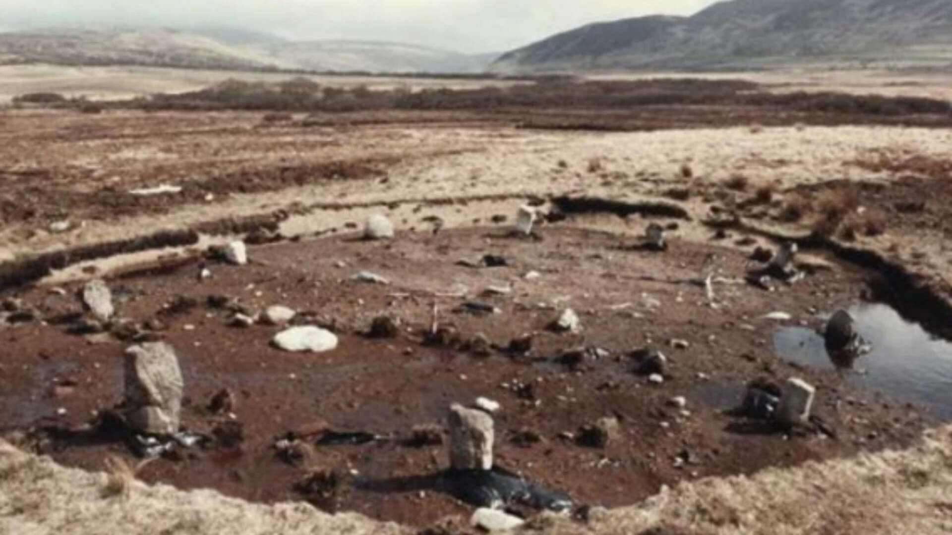
Machrie Moor isn't just a random collection of rocks. The site already boasts six well-known standing stone circles, labeled simply as Circles 1 through 5, and Circle 11. This new find makes seven.
Neolithic and Bronze Age farming communities built these monuments between 3500 BCE and 1500 BCE. They spent incredible physical effort moving materials and organizing labor. Why?
The landscape gives us a massive clue. The existing circles align precisely with a prominent notch in the horizon at the head of nearby Machrie Glen. If you stood in these circles thousands of years ago during the midsummer solstice, you'd watch the sun rise perfectly within that mountain notch.
It was a giant, landscape-scale calendar. While we can't definitively prove the new underground circle shares this exact astronomical alignment until more data comes in, its position within the broader grid makes it a near certainty. These communities used the sky to dictate when to plant, when to harvest, and when to gather for intense spiritual or social rituals.
Moving Beyond the Shovel
The fact that this ritual circle was found without digging is a massive win for modern archaeology. Traditional excavation is destructive. Once you dig up a site, you change it forever.
By utilizing advanced geophysics, archaeologists are essentially taking an MRI of the earth. Dr. Hannon noted that the ability to map our history without disturbing the ground means we can protect ancient remains while still rewriting history books.
The technology is also correcting our past guesses about the monuments we can see. While scanning the area, the HES team ran their gear over Circle 2—the famous spot where three towering red sandstone pillars stand. For years, reconstructions suggested it originally held seven or eight stones. The new subsurface data revealed a ring of hidden underground anomalies showing Circle 2 actually contained 14 standing stones.
What This Tells Us About Prehistoric Arran
This discovery alters our view of how prehistoric people used Machrie Moor over long stretches of time.
Thanks to earlier excavations at the visible sites, we know these monuments evolved. They didn't just build a stone circle and leave it alone. Often, a community would erect a timber circle first. Centuries later, their descendants would pull down the rotting wood and replace it with massive stones. Later still, during the Bronze Age, the purpose shifted entirely; the circles became sacred cemeteries used for cremations and burying elite members of the tribe.
Because the new circle sits completely underground, frozen in time beneath the peat, it offers an untouched look at an early phase of this sacred space.
Your Next Steps for Exploring Machrie Moor
If you're planning a trip to the Isle of Arran or just want to dive deeper into Scotland's prehistoric mysteries, don't just read about it from afar.
- Visit the Site: Machrie Moor is accessible via a walk from the car park near Blackwaterfoot on Arran's west coast. You can walk right up to the visible stone circles, including the towering pillars of Circle 2.
- Track the Updates: Keep tabs on official updates from Historic Environment Scotland. They regularly publish technical survey reports and open-access data as their research continues.
- Look for the Hidden Lines: When you stand on the moor, look toward the head of Machrie Glen. Position yourself to see how the visible circles interact with the landscape, keeping in mind that another massive ritual structure is resting right beneath your boots.